
By LEAH WILLINGHAM and JEFF MARTIN Associated Press
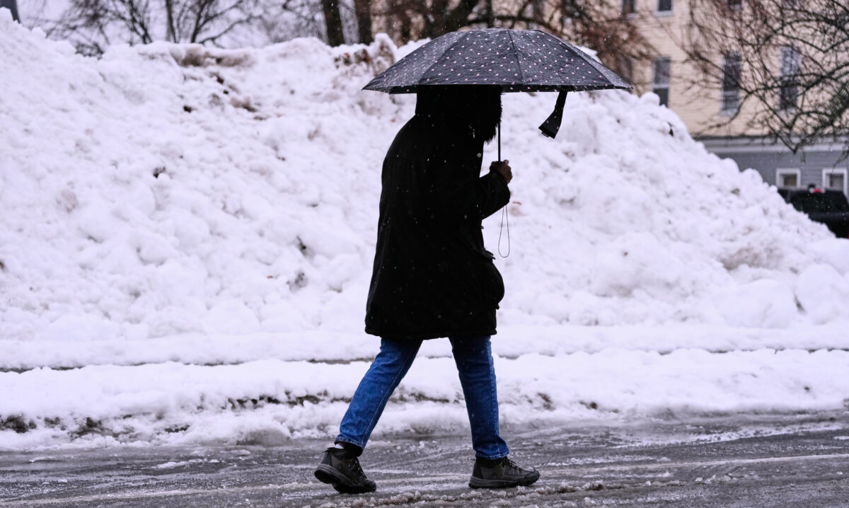
A potent winter storm brought blizzard conditions, treacherous travel and power outages in parts of the Upper Midwest on Monday as other areas of the country experienced plunging temperatures, strong winds and a mix of snow, ice, and rain.
The snow and strengthening winds began spreading Sunday across the northern Plains, where the National Weather Service warned of whiteout conditions and blizzard conditions that could make travel impossible in some areas. The wind and snow created “a pretty significant system for even this part of the country,” said Cody Snell, a meteorologist with the Weather Prediction Center.
A strong area of low pressure tracking from the Great Lakes into southeast Canada was bringing snow to parts of Michigan on Monday, he said. Powerful winds and heavy lake effect snow were expected across the Great Lakes into New York, and rain and a wintry mix in the northeast.
In central Ohio, the National Weather Service issued a wind advisory until 6 p.m. Monday, Dec. 29, saying that gusty winds would blow around unsecured objects “and tree limbs could be blown down and a few power outages may result.”
The weather service urged motorists to use extra caution, especially if operating a high profile vehicle.
The weather service forecast for Licking County called for west winds of 15 to 25 mph with gusts up to 40 mph in the evening and a 30 percent chance of snow. Tuesday will be mostly cloudy in the morning, then becoming partly cloudy, with highs in the mid 20s. West winds will continue at 15 to 20 mph with gusts up to 30 mph. Tuesday night will be mostly cloudy with a 50 percent chance of snow. The lows will be in the lower 20s, and west winds will be 10 to 15 mph with gusts up to 25 mph.
Wednesday will be mostly cloudy with a slight chance of snow in the morning, then a chance of snow in the afternoon. Highs are expected to be in the lower 30s. West winds will be 15 to 20 mph. The chance of snow on New Year’s Eve is 50 percent, and at night, the chance of snow increases to 80 percent with lows between 10 and 15.
New Years Day will be partly cloudy with a chance of snow in the morning. It is expected to be unseasonably cold with highs in the mid 20s. The chance of snow is 50 percent. Thursday night will be partly cloudy with lows around 15.
The storm system that moved across the Upper Midwest to the East Coast could be considered a bomb cyclone since it rapidly deepened from the Midwest into the Great Lakes, Snell said. Storm intensity is measured by central pressure, so the lower the pressure, the stronger the storm.
The very strong cold front meant parts of the central U.S. woke up Monday to temperatures up to 50 degrees F (28 degrees C) colder than a day earlier, according to the Weather Prediction Center. The winds brought “dangerous wind chills” that were expected to drop as low as minus 30 F (minus 34 C) in North Dakota and into Minnesota into Monday.
Blizzard conditions eased in northern Iowa, but high winds blowing fallen snow kept more than 200 miles of Interstate 35 closed Monday as state troopers reported dozens of crashes during the storm, including one that killed a person.
Snowfall in Michigan’s Upper Peninsula ranged from 19 to 24 inches (48 to 61 centimeters), said Ryan Metzger, a National Weather Service meteorologist. More snow is expected in the coming days, but it will be “much lighter, a little bit here or there,” he said. “Nothing like what we had overnight.”
In New England, there were reports of freezing rain in parts of northern New York with that threat extending into Vermont, New Hampshire and Maine, Snell said, noting that it can put a strain on power lines and trees.
In California, the weather service warned that moderate-to-strong Santa Ana winds were expected in Los Angeles and Ventura counties through Tuesday, with a high risk for downed trees due to soaked soils. Recent powerful storms brought the wettest Christmas season to Southern California in years. Two more storms are likely later this week, with forecasters warning that rain on New Year’s Day could soak the Rose Parade in Pasadena for the first time in two decades.
Nationwide more than 350,000 customers were in the dark Monday morning, with about a third of those power outages in Michigan, according to Poweroutage.us. There were more than 3,500 flight delays and more than 600 cancellations at U.S. airports on Monday, according to the flight tracking site FlightAware.
An EF1 tornado with estimated peak winds of 98 mph (158 kph)touched down in Illinois’ Tazewell County on Sunday morning, destroying two outbuildings and snapping off numerous trees and power poles, according to the weather service’s office in Lincoln, Illinois. On Monday, the office was surveying damage in Macon County after severe thunderstorms moved through the area on Sunday.
Most of Michigan’s Upper Peninsula was under a blizzard warning Monday morning, according to the weather service with wind gusts of up to 60 mph (96 kph) expected along parts of the southern shore of Lake Superior. Blizzard conditions continued in some parts of northern Iowa on Monday morning.
Forecasters warned of 1 to 3 feet (about 30 to 91 centimeters) of lake-effect snow from Monday through Thursday and high winds, with gusts up to 75 mph (121 kph), in western New York on Monday. Similar conditions were expected along Lake Erie in Michigan and Ohio.
In the South, meteorologists warned severe thunderstorms are likely to signal the arrival of a sharp cold front — bringing a sudden drop in temperatures and strong north winds that will abruptly end days of record warmth throughout that region. The colder temperatures in the South are expected to persist through New Year’s Day.
The storm is expected to intensify as it moves east, drawing energy from a sharp clash between frigid air plunging south from Canada and unusually warm air that has lingered across the southern United States, according to the National Weather Service.
Alan Miller, of The Reporting Project, contributed to this story.