

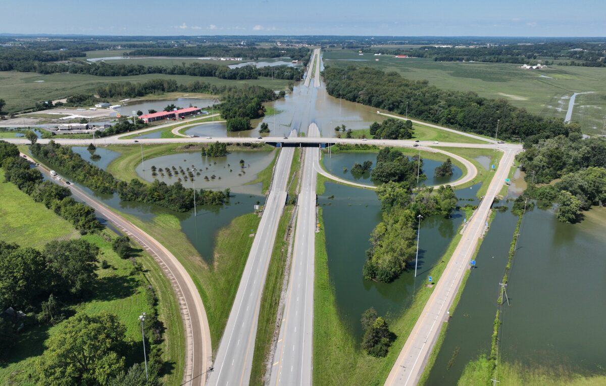
A week after a historic flash flood swept through Pataskala and washed over Hebron, Buckeye Lake Village and I-70, most folks in Licking County had moved on with their lives.
But for victims across the county whose homes filled with water on Aug. 20, the initial shock of seeing a raging torrent in the South Fork of the Licking River rip through Pataskala and points southeast of there was followed by this question to public officials: What are you doing to make sure this doesn’t happen again?
“We hear about it when it happens, and then it gets quiet when the water recedes,” said Licking County Commissioner Rick Black, a fifth-generation farmer who is among those who do not forget the flooding, because his family once farmed the low-lying land near where I-70 was closed by flooding last week.
During the quiet times, work continues by a host of government agencies – local, state and national – on a long list of studies and potential projects to address the problem. And as with many complicated issues, there are many angles to pursue, there is never enough money, and there is no silver bullet to stop flooding.
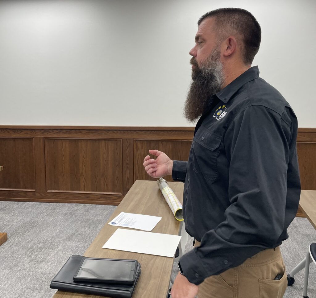
Among the local government offices involved in that process is the Licking County Emergency Management Agency. After the recent departure of director Sean Grady, long-time deputy director John Wieber was named the agency’s interim director on Tuesday, Aug. 18. Two days later, the flood began, and he hit the ground running, coordinating with fire departments and police agencies for water rescues and evacuations.
| Read more: I-70 reopens in both directions at Buckeye Lake, but some ramps at Rts. 79 and 37 remain closed Saturday morning
Then came coordination with local governments and service agencies, such as the Red Cross and Licking County Transit, to help victims access shelter, food and clothing. And soon, attention will return to working with others on long-term efforts to mitigate flooding.
Wieber met with the county commissioners on Thursday, Aug. 27, to give them an update on the flooding and, in a touch of irony, to receive a proclamation in recognition of National Emergency Management Awareness Month.
“It was unbelievable how everyone pulled together to support the recovery effort,” Wieber said.
Eliminating logjams
One reason the floodwater rose so fast in Pataskala is sitting in the South Fork of the Licking River next to the mobile-home park that took the brunt of the flooding east of Main Street in the heart of the old village.
It’s a logjam – a jumbled pile of large trees that grows taller and more dense each time rain pushes more trees and limbs onto the pile.
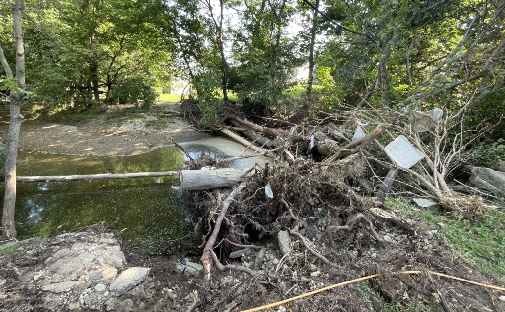
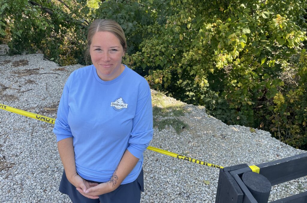
Up stream, the water behind that natural dam rose so fast and moved so swiftly that it ate away five feet of the riverbank behind The Dairy Hut, a popular ice-cream and hot-dog shop between the South Fork and Main Street.
Heather Schmidt, who owns the business and a local pizza shop with her best friend Ashlee Powell, said the floodwater rose to within an inch of the back door of The Dairy Hut. So business resumed as soon as the road opened and the power was restored.
But the damage to their property was just beyond the back door. Land that had provided a safe cushion between the business and the river was gone. Another flood could undermine the building.
“It was crazy,” Schmidt said, recalling how she could watch in real time on a security camera at the shop. “The water just kept getting higher and higher.”
When she was finally able to get to the shop, she watched in disbelief as the fast-moving water undermined a tree and sent it tumbling into the river.
And then she saw how much of the riverbank was gone.
“We’ll have to rebuild the riverbank with stone,” she said, adding that she has met with some contractors. “It’s not as easy as just dumping in stone. It has to be done carefully, and you have to have permission from the Army Corps of Engineers and the EPA.”
And if and when a plan is approved, there would most certainly be a significant cost, which insurance will not cover, Schmidt said.
“How will we pay for it? I honestly don’t know,” she said. “The Lord’s not going to put more on me than I can handle. We’ll get through this.”
The logjam in Pataskala is one of hundreds of such natural dams littering the South Fork watershed and contributing to flooding, said Kristy Hawthorne, executive director of the Licking County Soil and Water Conservation District. An AmeriCorps project in 2020 identified more than 400 obstructions in Raccoon Creek alone.
Her agency has a $500,000 grant to work with the U.S. Army Corps of Engineers to remove logjams from Raccoon Creek, which flows from the Johnstown area southeast through Alexandria and Granville and into Newark, where it meets the South Fork of the Licking River.
The office has a multi-faceted approach to mitigating flooding, starting with being part of the review process for proposed development in the county – to make sure that massive roof structures, roadways and parking lots covering former farmland are designed to shed rainwater into retention ponds rather than rushing into the nearest stream.
The soil and water district also has received grants totalling more than $500,000 to study the 185 square miles of the South Licking watershed. One study will identify projects that would reduce flooding, such as building “dry dams” that would hold back water and allow it to flow slowly back into streams. Another grant helped develop a computer program that allows for two-dimensional modeling of the waterways.
The 2D modeling uses details about geography and hydrology to generate images showing where water will flow after plugging in variables such as rainfall totals and duration of the rain. It also can help determine how changes in the landscape, such as building a dry dam, would affect flooding.
And armed with insights from the 2D modeling, Hawthorne said the agency won a Federal Emergency Management Agency (FEMA) grant of $328,000 and an $84,000 grant from the Licking County Commissioners to explore potential projects along the main stem of the South Fork.
Meanwhile, the agency also coordinates and collaborates with FEMA, the Corps of Engineers, the Muskingum Watershed Conservancy District, the South Licking Watershed Conservancy District, the Ohio Department of Transportation (ODOT) and local governments to make sure their projects complement any others that might be in the works.
“We took the 2D data and combined it with ODOT data, on-the-ground observations and other information, and we’re now evaluating five potential projects,” Hawthorne said. “We anticipate having this completed by early 2027.”
And at that point, they will need money to take on the projects, so while flooding is fresh in their minds, Hawthorne is talking with state and federal officials to plant seeds about the needs – and the long-term benefit of investing in flood mitigation versus the cost of responding to and recovering from repeated floods.
“They were very interested,” she said about conversations with elected officials. “We had drought conditions the past two years, so it hasn’t been top of mind. But now everyone wants to know what we’re doing.”
Two floods in one day
The consequences of last week’s weather disaster go far beyond the immediate floodwaters and can linger for weeks, months and even years.
The residents of Hebron found themselves amid two floods in one day. First came the rising river, which spilled into basements and required evacuation of about 100 residents of the Greenbriar Village mobile home park – where flooding is attributed to a nearby logjam.
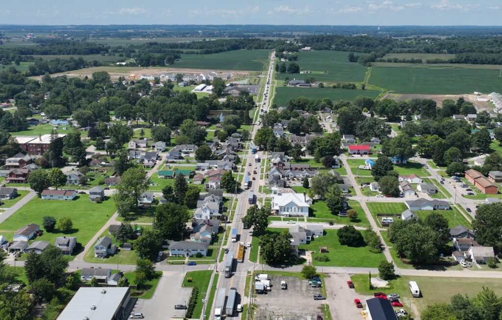
Then came the flood of traffic. When ODOT shut down all lanes of I-70 between Hebron and Buckeye Lake Village because they were submerged in water, traffic was diverted onto Rt. 40, which runs through the heart of Hebron.
“We had bumper-to-bumper traffic in Hebron for hours,” said Mayor Valerie Mockus. “And we don’t have bumper-to-bumper traffic in Hebron, Ohio.”
It was a bit of a fun distraction for children whose schools had been closed by the flood, Mockus said.
“Some were standing along the road making that motion to get honks from the truckers,” she said. “But from a practicality perspective, it was very challenging for residents just trying to get to Kroger. And that included a lot of heavy truck traffic, which is hard on the roads. And all of that traffic raised concerns about the ability for first responders to get to emergencies.”
While floods in recent years sometimes resulted in wet basements, she said, this time it rose so high that it was into the first floors of some homes, and recovery will take months.
She said she was impressed with how neighbors helped neighbors and neighboring communities helped Hebron.
“We had people coming out of the woodwork to help,” she said. “The challenge is coordinating all of the help that is offered. I’m told that we did well for a village, but it was still like drinking water from a firehose.”
She said that Village Administrator Brittany Misner, who previously was vice president of the Licking County Chamber of Commerce, “already had superior skills in bringing together people – relationships with churches and nonprofits in particular. So now, all of a sudden, the churches, for example, were coordinating and working together to leverage the talents and skills in each congregation.”
And even while working to help residents with recovery, Hebron officials are working on projects within the village – in coordination with other agencies and their plans – to mitigate local flooding.
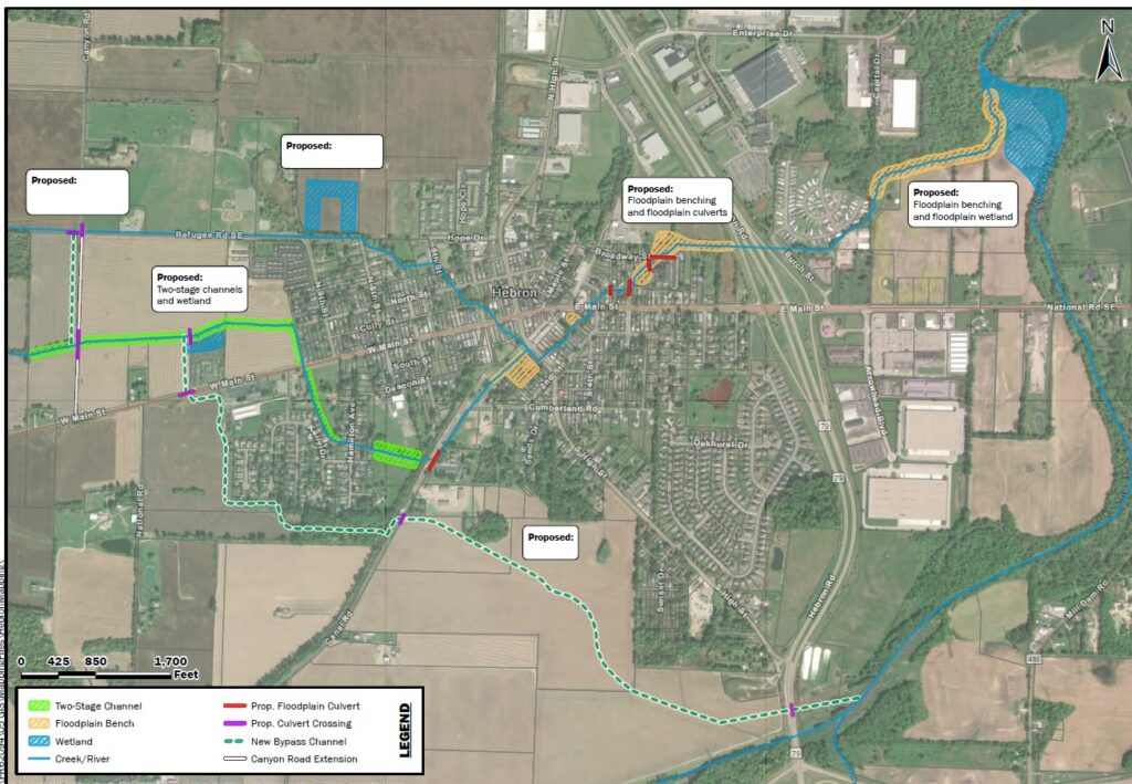
One of them is a three-phase project to build overflow channels that will hold and carry runoff away from Hebron neighborhoods. One of the three segments has been built, in partnership with M/I Homes, which is building a subdivision on the west side of town.
Microsoft, which is building a data center on the west side, has committed to partnering on another segment. And Mockus is still looking for a partner for the third segment, which is on the south side of town and the one closest to I-70 and Rt. 79, which is a perennial flood zone.
Ideally, she said, that portion of the overflow channel would empty onto village-owned land on the east side of Rt. 79 – the village’s water-well field.
“We’re interested in moving water out of the village, but have to be mindful that the water we push out goes somewhere else. We don’t want to cause harm to anyone downstream. So, if it could go under Rt. 79 and end it on land the village owns, it would be a win.”
The challenge, she said, would be the cost of a culvert under Rt. 79, or a bridge over the channel. She’s hoping that perhaps ODOT could be a partner on that portion of the overflow channel and incorporate it into whatever it does to lift I-70 out of the floodplain.
Alan Miller writes for TheReportingProject.org, the nonprofit news organization of Denison University’s Journalism program, which is supported by generous donations from readers. Sign up for The Reporting Project newsletter here.