
After a Tuesday night of heavy rain, a spectacular lightning show, strong winds, closed roads and tornado warnings, Licking County on Wednesday morning saw floodwater receding dark clouds make way for some brief sunshine.
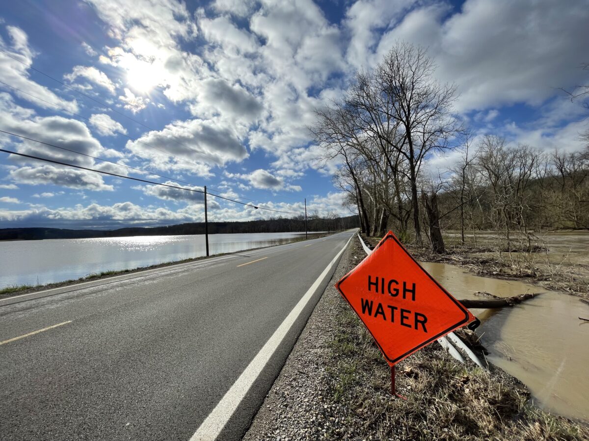
Many roads that had been closed Tuesday afternoon and into the night were open on Wednesday morning, even as water lapped at the edges of the pavement, such as on Brownsville Road SE just north of Rt. 16 near Marne. Two ramps on I-70 at Buckeye Lake remained closed Wednesday morning. They were the eastbound exit ramp from I-70 to Rt. 79 and the westbound entrance ramp from Rt. 79 to I-70.
Raccoon Creek remained swollen in Alexandria, which had seen heavy flooding in a park along Raccoon Creek on the southeast side of the village, but the water had receded from the park by Wednesday morning. The same was true in Granville, where Raccoon Creek flooded low-lying areas.
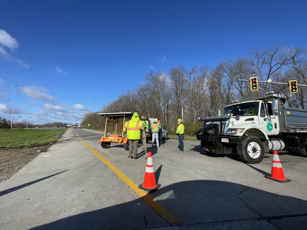
In Newark, a city street crew on Wednesday morning removed the floodwall gate across S. 2nd Street.
The National Weather Service had issued a tornado watch for most of central Ohio, including Licking County, at 6:15 p.m. Tuesday, and it will be in effect until 10 p.m. A tornado warning later was issued for the southern portion of Licking County. A tornado siren sounded briefly in Granville.
The American Red Cross Central & Southern Ohio Region opened an emergency shelter at Holy Trinity Lutheran Church on West Main Street in Newark to house Newark residents displaced by flooding. Newark Police had asked residents of mobile homes at the Canterbury Trails Park on the south side and the Little Texas neighborhood on the southeast side to evacuate as floodwaters rise.
It was evident on Wednesday morning that both of those areas experienced some flooding, and Forry Street near Canterbury Trails was still partly covered by floodwater.
After steady rain Monday into Tuesday, low-lying areas along Raccoon Creek and other streams in Granville, St. Albans and Union townships had closed roads or was threatening to close them by late Tuesday morning. A flood watch was in effect until 11 p.m. Tuesday.
The westbound entrance ramp to I-70 from Rt. 79 near Buckeye Lake was closed Wednesday morning because of flooding. 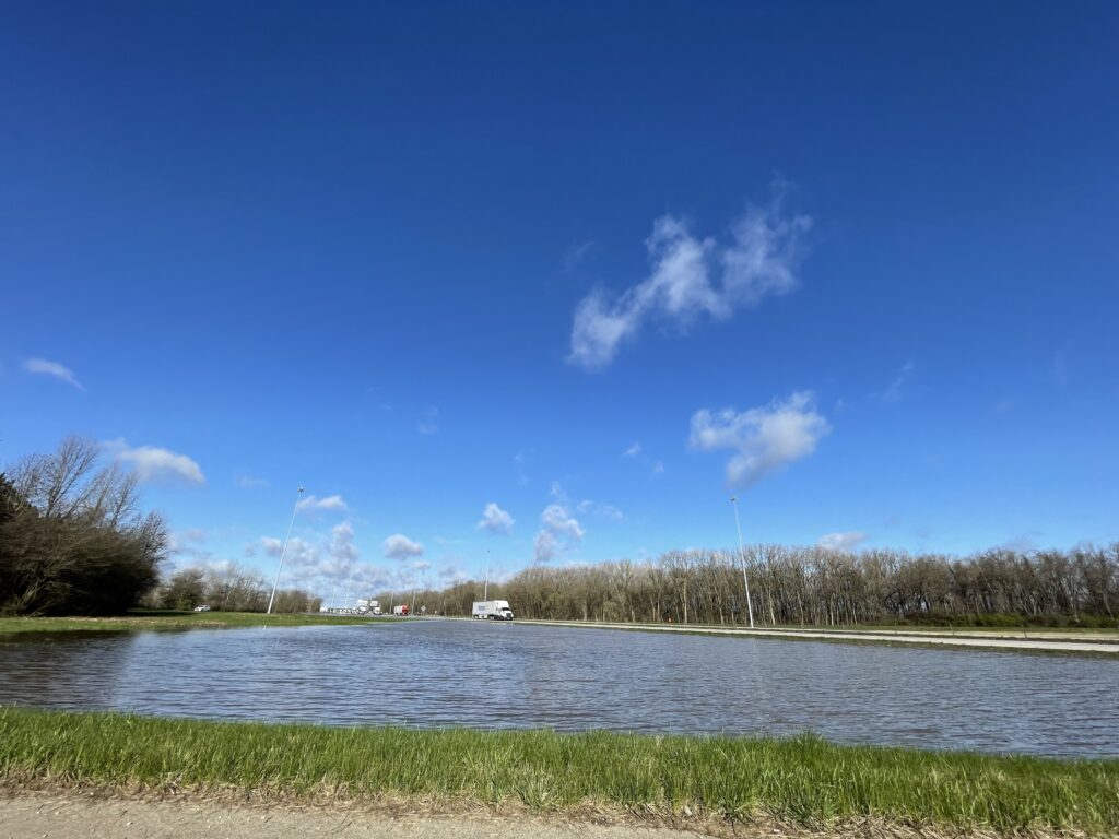
The eastbound exit ramp from I-70 to Rt. 79 near Buckeye Lake was closed Wednesday morning because of flooding. 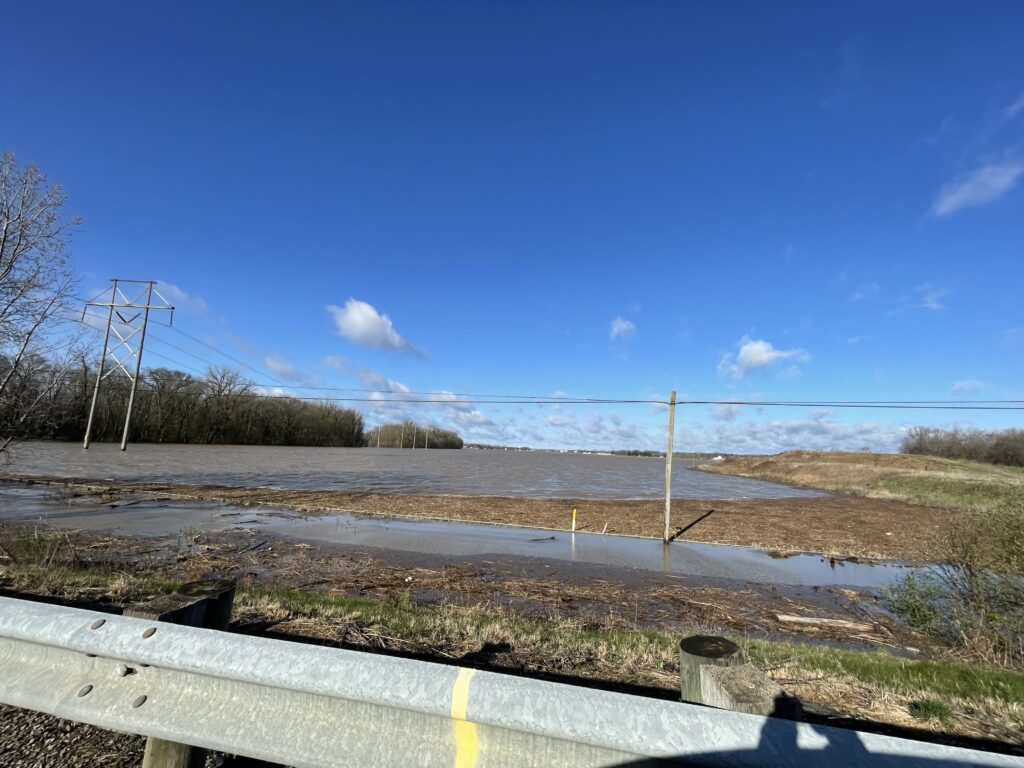
Fields along the South Fork of the Licking River near Hebron and I-70 were still deep under floodwater on Wednesday morning. 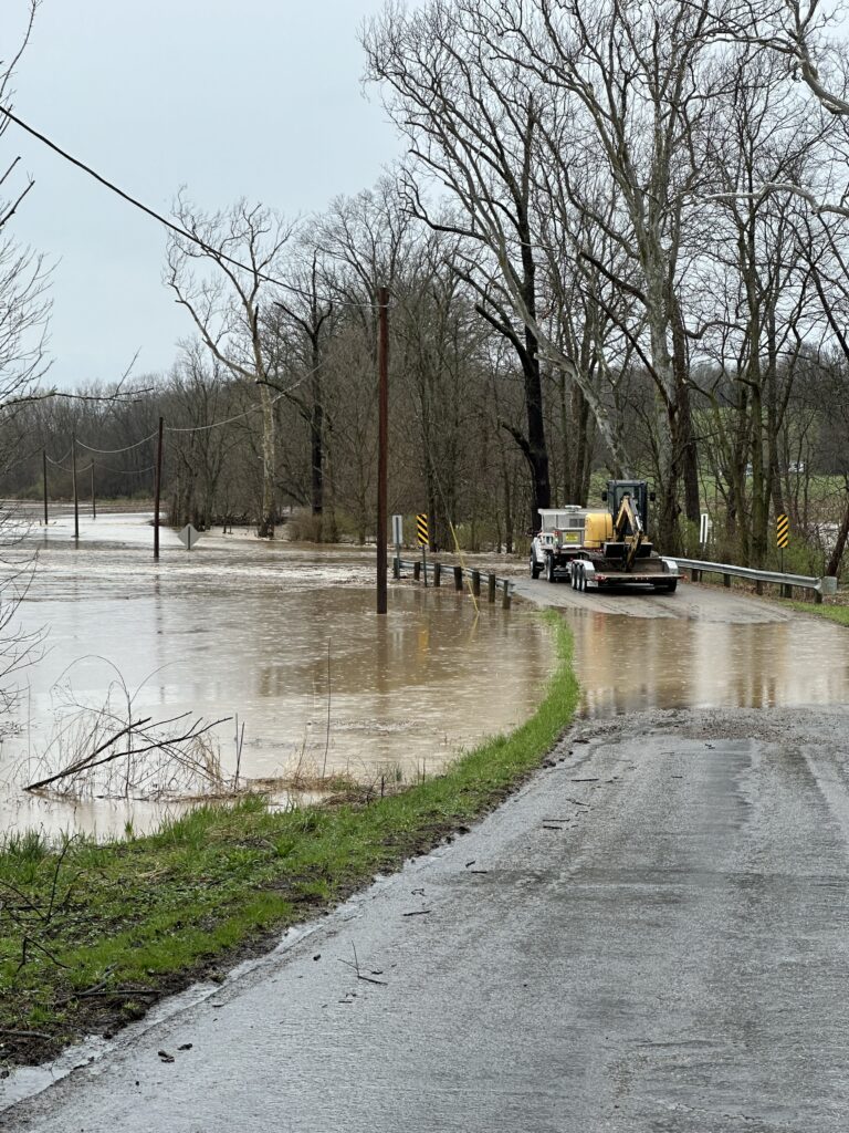
A McKean Township road crew examines flooding on Dry Creek Road NW, west of Burg Street and northwest of Granville. 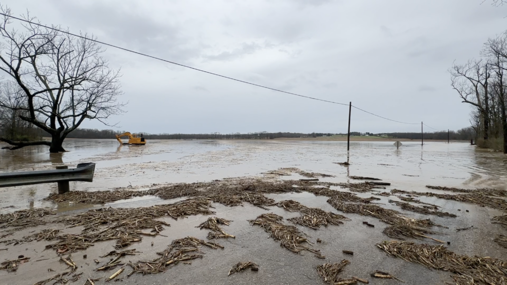
The flood waters that covered Dry Creek Road NW, west of Burg Street and northwest of Granville, also spilled into nearby farm fields. 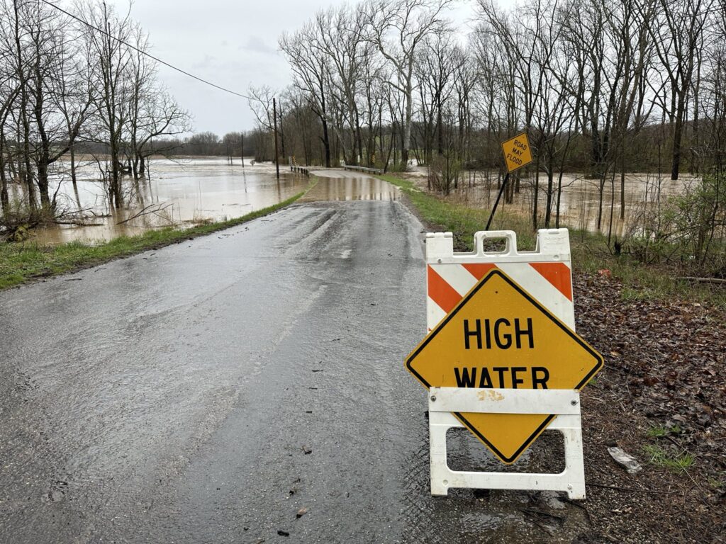
Dry Creek Road NW, west of Burg Street and northwest of Granville, was closed Tuesday morning because of flooding. 
Sections of Dry Creek Road near Burg Street were completely underwater Tuesday morning. 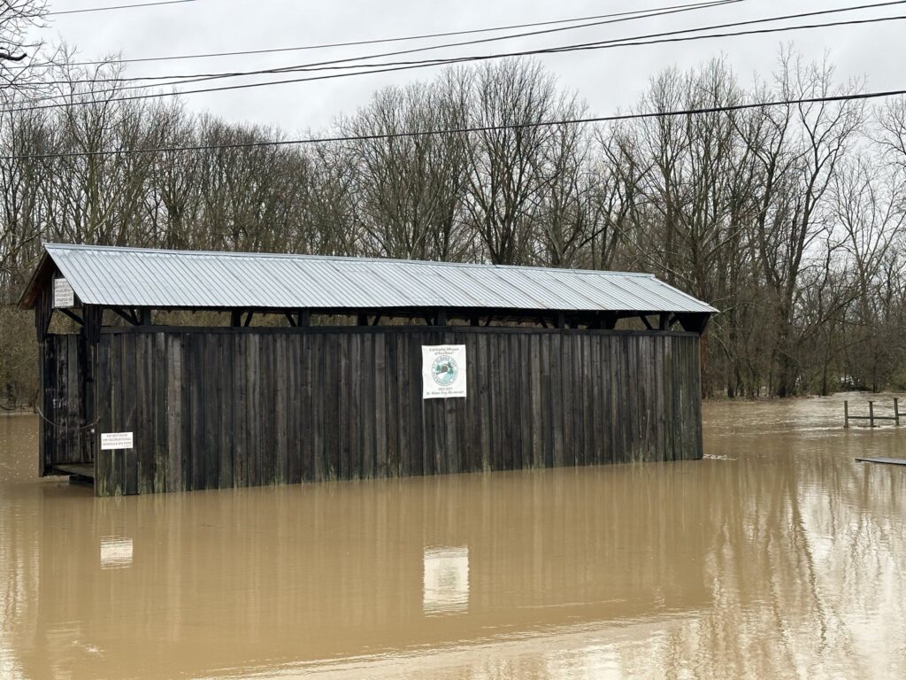
A rising Raccoon Creek spilled over its banks and into low-lying areas of Alexandria by late Tuesday morning. 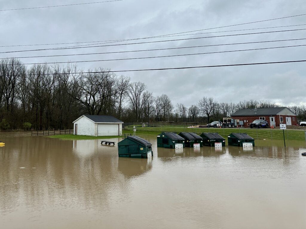
The rising waters of Raccoon Creek inundated low-lying parts of Alexandria on Tuesday. 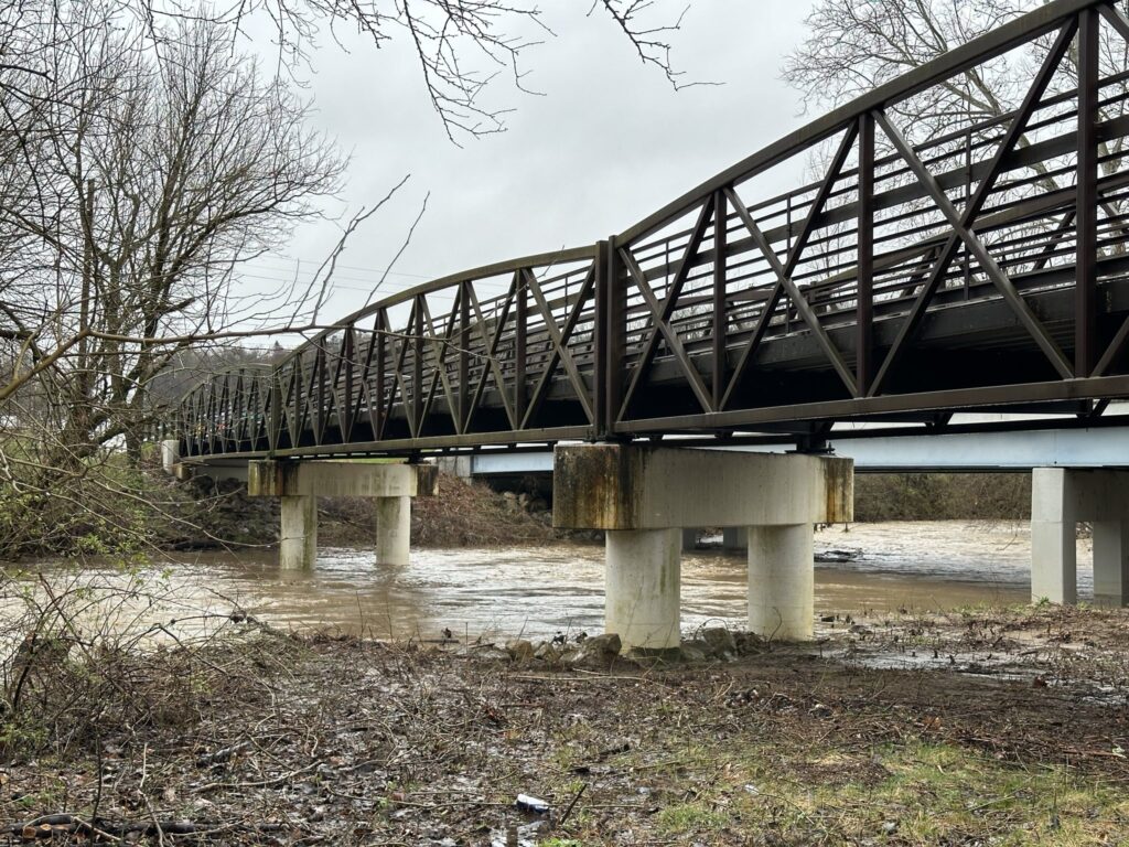
A flood warning is in effect for Tuesday through 11 p.m. , and the National Weather Service said that Racoon Creek, seen here on the south side of Granville, would crest at 13.9 feet, which is nearly a foot above flood stage. 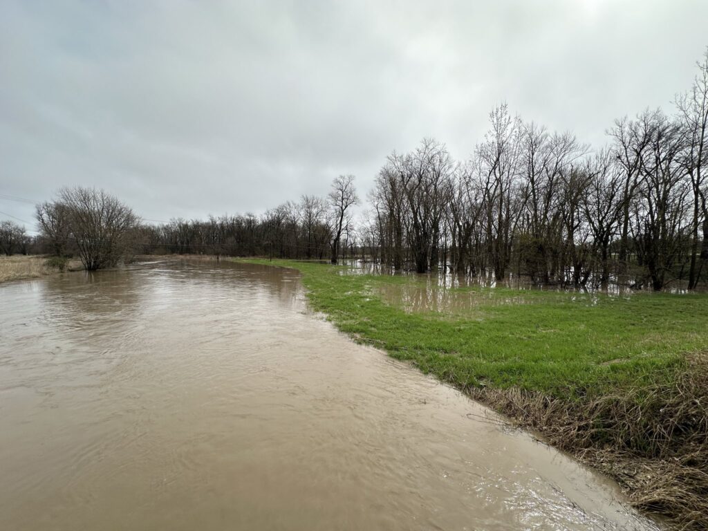
The South Fork of the Licking River between Hebron and Buckeye Lake is prone to flooding, and it happened again Tuesday after more than 2 inches of rain fell on Licking County early Tuesday morning. 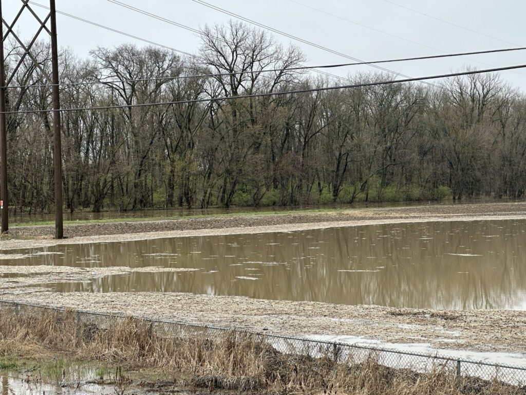
The South Fork of the Licking River between Hebron and Buckeye Lake is prone to flooding, and it happened again Tuesday after more than 2 inches of rain fell on Licking County early Tuesday morning.
Across Licking County, rivers and streams were brown, muddy and filled with debris after several inches of rain fell overnight Monday.
Portions of Moots Run Road west of Granville were flooded with water breaching the bike path on the west side of Granville, the weather service reported. It said that water would approach Granville Square Apartments between the bike path and West Broadway, as well as the operational building of the Granville Water Plant and the Granville Wastewater Treatment Plant, both of which are along Raccoon Creek on the south side of the village.
The weather service reported that water was nearly one foot deep on Sleepy Hollow Road, portions of Nathaniel Avenue and Southeast Summit Road, southeast of Newark. And it said water was encroaching on areas in the vicinity of the Canterbury Trails Mobile Home community near Licking View Drive and Forry Street.
Licking Valley schools were closed Tuesday because of flooding in the area. North Fork schools dismissed students early in the afternoon. Newark City Schools and Granville schools cancelled all after-school activities.
Authorities say no one should attempt to drive through flooded roadways because the water could be deeper and moving faster than it might appear on the surface. And the weather service advises: “Turn around, don’t drown when encountering flooded roads. Most flood deaths occur in vehicles.”
After an afternoon lull in the storms that included brief spots of sunshine, rain moved into Licking County again around 2:30 p.m. Tuesday.
“Additional showers and thunderstorms will develop this afternoon and will continue into this evening,” the National Weather Service said late Tuesday morning. “The greatest window for severe storms to occur will be between 1 p.m. and 8 p.m. with the potential for all weather hazards. The weather hazards include damaging winds, large hail, and several tornadoes, some of which may be strong or intense.”
Some residents of Licking County reported more than 2 inches of rain fell overnight and into Tuesday morning, and that came on top of several bands of rain that pushed through the county on Monday. The weather service said Licking County could see another 2 inches Tuesday afternoon and evening. And by Wednesday morning, some areas were reporting having received 1 and a half to 2 inches of additional rainfall.
“Multiple rounds of showers and storms are expected through this evening,” the weather service said Tuesday. “Each round of storms will have the potential to produce heavy rain. Total rainfall amounts of 2 to 4 inches, with locally higher amounts possible.”
In Newark, the weather service said the North Fork of the Licking River was a foot above flood stage at 16 feet at E. Main Street and that the river was spilling into low spots of the Owens Corning property. It also said that Wildcat Park, between the river and Horns Hill Road NE north of Cedar Run Road NE, is flooded.
In Hebron, which has experienced period flooding in the past, Mayor Valerie Mockus said Tuesday that one street and the village park were closed because of flooding, and some residents have found a foot or two of water in their basements.
The South Fork of the Licking River runs along the eastern edge of the village, which south of Newark and Heath at the intersections of Rts. 79 and 40, just north of I-70 and Buckeye Lake.
She said the village was working with Licking County to replace some culverts that should help drain runoff away from the village more quickly, but that construction has not been scheduled yet.
Village officials were keeping a close eye on the next round of storms and would be prepared to respond if more flooding occurs, she said.
The National Weather Service said that winds in Licking County on Tuesday night would be 10 to 16 mph, with gusts as high as 29 mph. The low will be around 40. Here is the extended forecast:
On Wednesday, there is a slight chance of showers between 4 p.m. and 5 p.m., with a chance of showers and thunderstorms after 5 p.m. It will be mostly cloudy, with a high near 46. Rain showers are likely before midnight, then we could see rain and snow showers. Some thunder is also possible. The low will be around 34.
More rain, possibly mixed with snow, is expected on Thursday, becoming all rain after 3 p.m. The high will be near 45. Rain will continue until around 3 a.m., then tamper off.
Rain and snow showers are likely before 3 p.m. on Friday, with a chance of rain until around 9 p.m. It will be mostly cloudy at night with a high near 44.
And finally, the sun is expected to return on Saturday, when it will be mostly sunny with a high near 48 during the day and a low of 31 at night.
Sunday should be sunny with a high near 58 and a low at night around 40.
At this point, the prediction for Eclipse Monday is that it will be partly sunny, with a chance of ran and a high near 63.