

Each time it rains in central Ohio these days, it’s another reminder of the increasing potential for floods in Licking County.
Anxiety grows when the National Weather Service issues an alert, as it did on Thursday, April 11, announcing yet another flood watch.
And local officials say the concerns are twofold: One is the need for plans and funding to reduce runoff and keep waterways moving freely to diminish the potential for flooding. Another is to develop plans for helping Licking County residents affected by flooding.
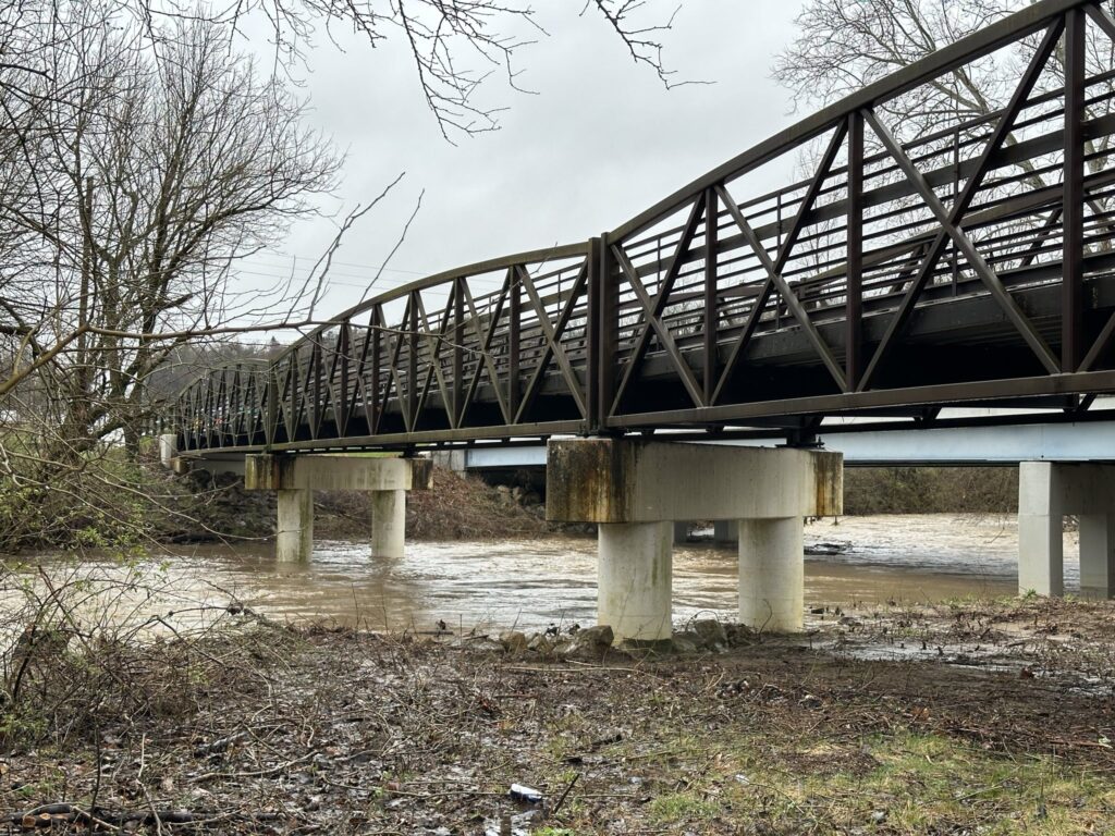
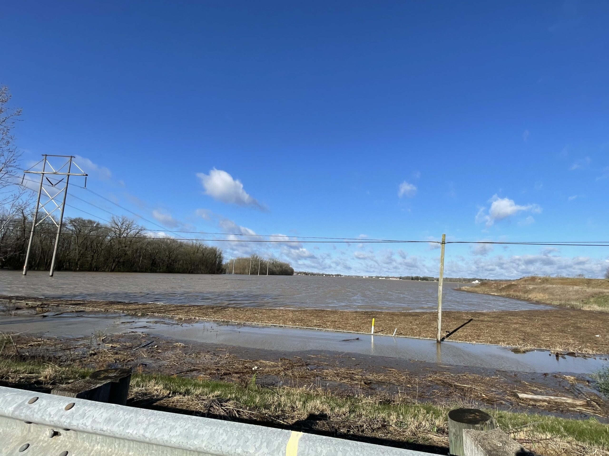
In the first week of April, a flood warning came ahead of storms that raked the county and spun up a couple of tornadoes. More than four inches of rain – a month’s worth – fell in less than 48 hours. That resulted in widespread flooding of farm fields, and detours when roadways and some bridges in Licking County were swamped. That included some main arteries, such as Rt 661 north of Granville and on- and off-ramps at I-70 and Rt. 79 at Buckeye Lake.
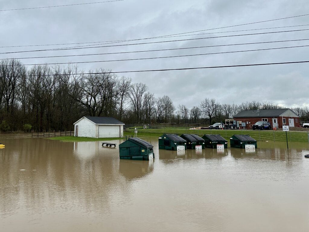
When flooding threatened two Newark neighborhoods that day, and police urged residents to leave their homes, there was no emergency plan or shelter in place to aid an evacuation. A Newark church scrambled volunteers at the last minute to open a temporary shelter.
“We have all of this development in Licking County, and we have more and more runoff, so we have flooding and emergency evacuations. We just don’t have enough planning,” said Bryn Bird, a Licking County produce farmer and trustee in Granville Township, where she said Raccoon Creek sees more regular flooding because of increases in heavy rain events, runoff from rooftops and parking lots in fast-growing northwestern Licking County, and debris in the stream.
In addition to threatening homes and businesses, flooding also could damage critical infrastructure, such as the water- and wastewater-treatment facilities in Granville, where Village Manager Herb Koehler said Raccoon Creek spilled over its banks on April 2 and flowed within a foot of sandbags piled outside the village facilities.
“We need collaborative, long-term planning,” Bird said. “We have these creeks and streams downstream (from Granville Township) that are flooding. We need emergency plans for housing for people being evacuated.”
While that hasn’t happened yet, there is an effort underway by the Licking County Soil and Water Conservation District to mitigate flooding by Raccoon Creek, which flows through Johnstown and Alexandria before flowing through Granville to Newark and into the Licking River – which overflowed on April 2 into the Little Texas neighborhood and the Canterbury Trails Mobile Home community, both on the south side of Newark.
Another project by the soil and water conservation district will seek to address flooding along the South Fork of the Licking River, which flows southeast from the Pataskala area toward Buckeye Lake and northeast through Hebron and Heath to the Licking River on the south side of Newark.
Kristy Hawthorne, program administrator for the Licking County Soil and Water Conservation District, said the is administering a $500,000 grant from the Muskingum Watershed Conservancy District to remove debris from Raccoon Creek.
“The Muskingum Watershed Conservancy District is 22 counties in Ohio and covers most of Licking County, because the Licking River watershed ends up in the Muskingum River,” Hawthorne said. “Their purpose is to reduce flooding within a watershed.”
As Bird describes Raccoon Creek, it is a serpentine series of tight turns and switchbacks, which are naturally conducive to filling with fallen trees and other debris that can clog the creek like cauliflower in your kitchen drain and cause flooding – or potentially slam into bridges and damage them.
“We hope to start doing some removals this fall,” Hawthorne said, adding that her office will seek more funding for longer-term flood mitigation on the stream.
In a separate initiative, the agency received a $250,000 grant from the Muskingum Watershed Conservancy District to do a detailed study of flooding along Raccoon Creek with the goal of additional mitigation in the future.
The study will collect information about the geography and land use in the Raccoon Creek watershed – “the waterways, flood plains, where water goes and depths of flooding, the hydrology and hydraulics, the science of flooding,” Hawthorne said.
“After Tuesday, we have lots of data to work with now,” she said about the April 2 flooding.
All of that data, including information from flow gauges along the creek, will allow the creation of a two-dimensional model of the Raccoon Creek watershed. Hawthorne also is collecting photos to show high-water marks, which will provide the depth of floodwaters during various events.
And that, Hawthorne said, will allow engineers to understand not only the breadth of the flooding but also the depth. “And with that data, we can run different scenarios – say, to make it rain 5 inches in an hour, and see where the water will go. It’s a good tool for coming up with the best projects to mitigate flooding in the watershed.”
A public forum about the project is being planned for early May in Johnstown, she said.
Her agency also has been awarded a $328,000 Federal Emergency Management Agency grant for flood mitigation along the South Fork of Licking River.
The grant application says that “the intent of this project is to mitigate historical flooding in the South Licking River Watershed (along) the Interstate I-70 corridor, mitigate flooding in rural and developed areas, and prevent adverse effects downstream, primarily between Pataskala to Heath.”
It also noted that “significant investment in commercial developments are being made in the South Licking Watershed. Currently, 32 major developments are either under construction or in review in the watershed,” and that flooding not only interrupts traffic on I-70, but it also negatively affects roads, homes, businesses, and prime farmland; causes emergency response challenges; and costs money with repetitive losses to buildings and structures.
“The flooding (on April 2) was nothing we hadn’t seen previously,” Hawthorne said, “but I think that these steps we are taking in finding funding are steps in the right direction to get corrective action. We can reduce the effects of flooding and increase the recovery time by taking these actions.”
Alan Miller writes for TheReportingProject.org, the nonprofit news organization of Denison University’s Journalism program, which is funded by the Mellon Foundation and donations from readers.